Weekend Rainfall Animation (Total Rains v. Rainfall > 0.5")
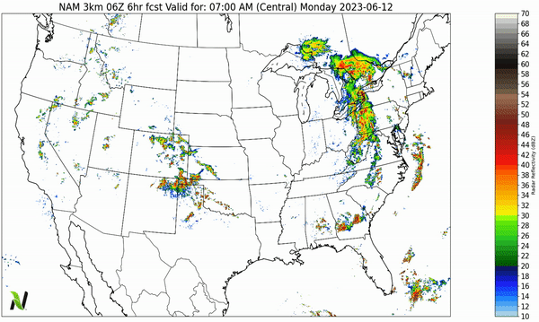
Hi-Res NAM Forecast through Midday Wednesday (simulated radar)
Main Story
Just a reminder, this email report is now being delivered once per week on Monday mornings.
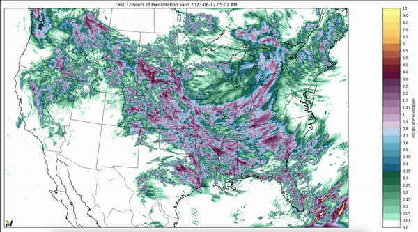
The top animation shows the last 72-hours of total accumulated precipitation masked for all locations that received more than 0.5" of rainfall. Large storms formed again from Texas, through the Front Range, into Montana, and throughout the Intermountain while severe storms moves through the Tennessee Valley into the Southeast and Appalachian Mts on Sunday. See Sunday's storm reports here and take a look at the size of the hail in the storms near Dallas, TX.
Highlights:
The cut-off low over Michigan keeps spinning through Wednesday delivering more rain Great Lakes Basin (which is in drought).
Heavy rains are moving into New England ending a very long stretch of no rainfall.
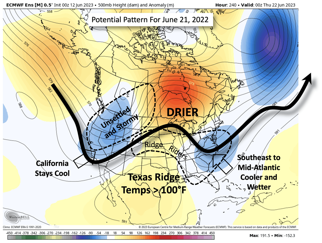
A large ridge builds into Texas keeping temps in Central Texas over 100°F. This ridge will likely set up the Plains and Midwest for repeated rounds of ridge-riding storms for the rest of June.
Fires continue in British Columbia, but rains later this week will likely put most of them out.
Repeated rounds of storms stretch across the South this week delivering severe weather but also very high rainfall amounts.
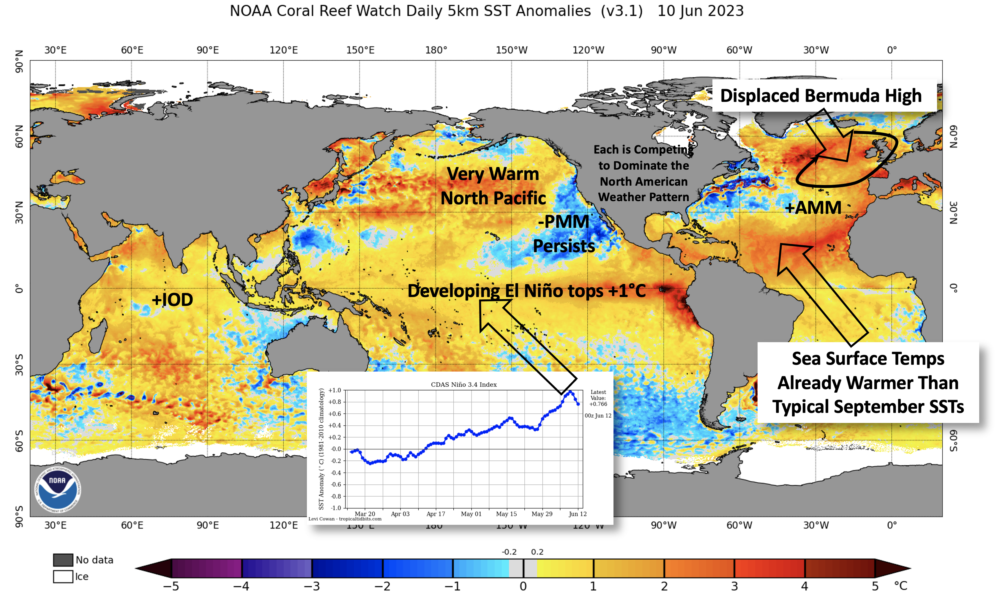
Tropical Atlantic ocean temperatures are already warmer than they typically are in September.
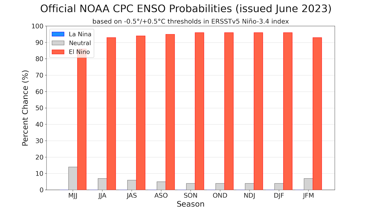
EL Niño continues to develop after topping +1°C last week.
We are 10-days away from the Summer Solstice and evolution of this spring weather pattern is truly unique. There are no strong analogs to 2023.
The evolution of the spring pressure patterns has been complicated by numerous competing factors including - none of which has taken over as the dominant player. This likely leads to numerous "regime" shifts through mid-summer before El Niño finally takes over. Here are the players:
A rapidly developing El Niño topped 1°C above average last week and will likely continue to add another degree-C over the next 2-3 months. This will classify as a "strong El Niño" by mid-summer. The CPC has given a better than 90% of EL Niño persisting through the next 11-Months.
The cold water off the Baja of California is called the negative phase of the Pacific Meridional Mode. This cold water is helping California stay cooler, but it could soon enhance the subtropical jet stream through the Southern Plains leading to more storms in the Central Plains, Midwest, and MidSouth.
The Bermuda High is gone... It's spent all of Spring over near the UK and Spain. This has allowed troughs of colder air to set up along the Southeast. Without the Bermuda High near its normal home near Bermuda, it's difficult for the atmosphere to pump Gulf of Mexico moisture into the Cornbelt.
The Tropical Atlantic ocean temperatures are already as warm as they are during the peak of the Hurricane Season. Ocean temperatures are directly correlated with hurricane intensity.
Maps/Graphics to Consider.
11-Month CPC Forecast for the Probability of El Niño
Current Sea Surface Temperature Analysis
June 21, 2023 Jet Stream Pattern and Resulting Weather
11-Month CPC ENSO Probability Forecast
Current Sea Surface Temperature Analysis
June 21, 2023 Jet Stream Pattern Analysis
Recent Weather
Last week marked the end of a 6-week long jet stream pattern that was stagnant over the Great Lakes and Canada and active throughout the Western Plains (Texas to Montana) and Intermountain West.
This pattern only broke down when a low set up over Michigan late this weekend (see the top of the email for the details).
Here are a few maps to examine:
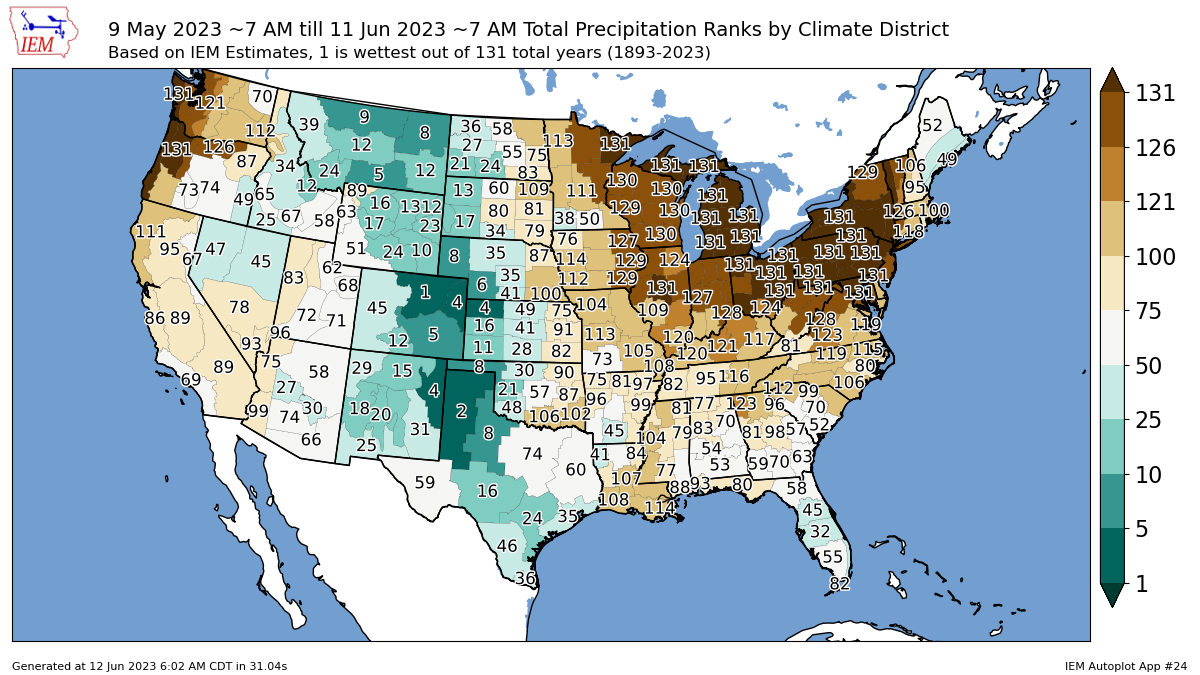
May 10 - June 11 Precipitation Ranks by Climate District
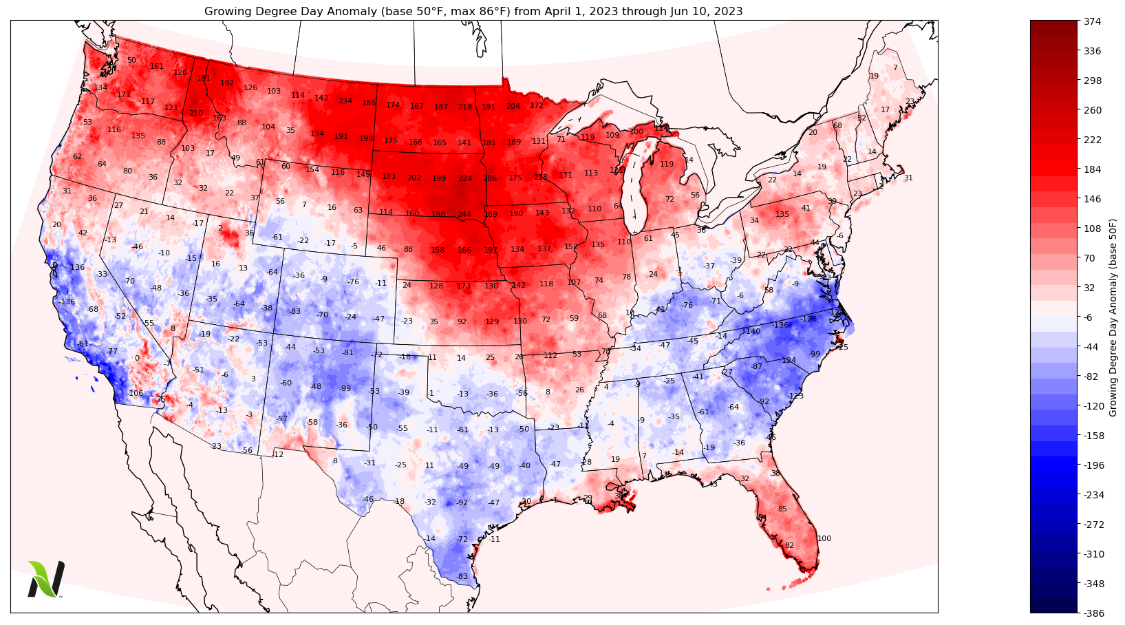
April 1 - June 10 Growing Degree Day Anomalies
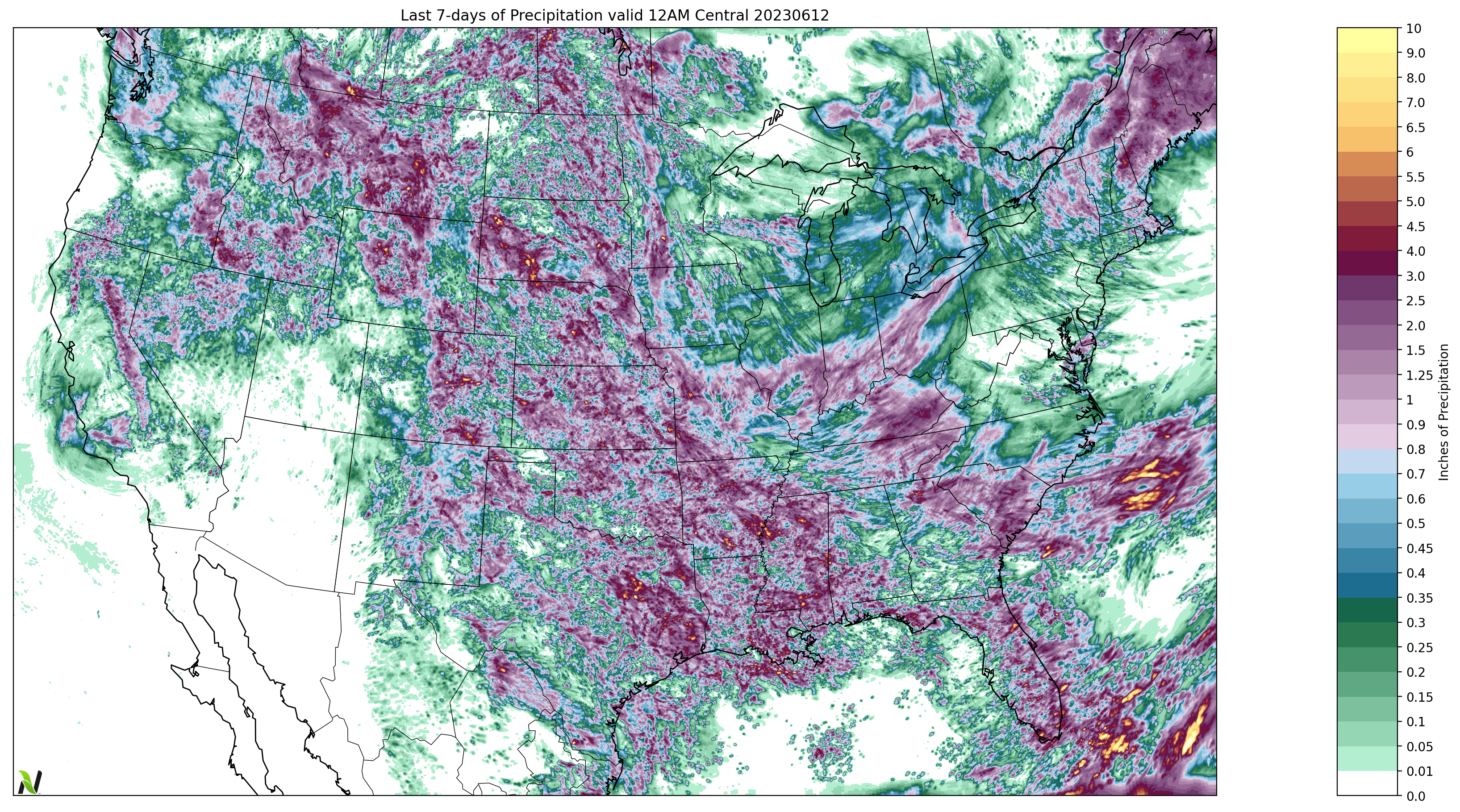
Last 7-Days of Total Precipitation through 12AM today
May 10 - June 11 Precipitation Ranks by Climate District
April 1 - June 10 Growing Degree Day Anomalies (base 50°F, max 86°F)
Last 7-Days of Total Precipitation through 12AM this morning.
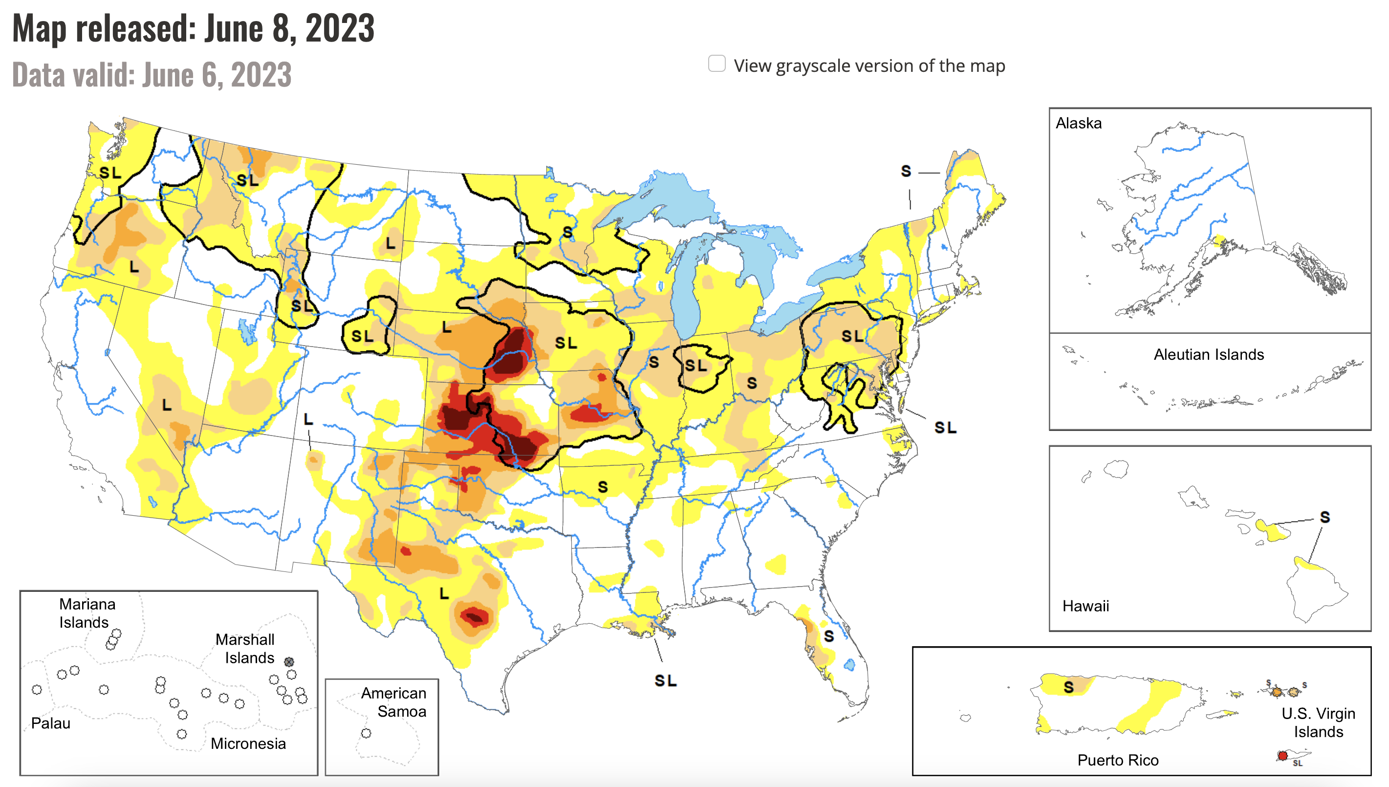
Latest Drought Monitor
Next 7-Days
Two features are developing that are leading to a pattern shift for North America. First a ridge is developing in Texas and Mexico. Second, a deeper West Coast trough is forming.
Implications:
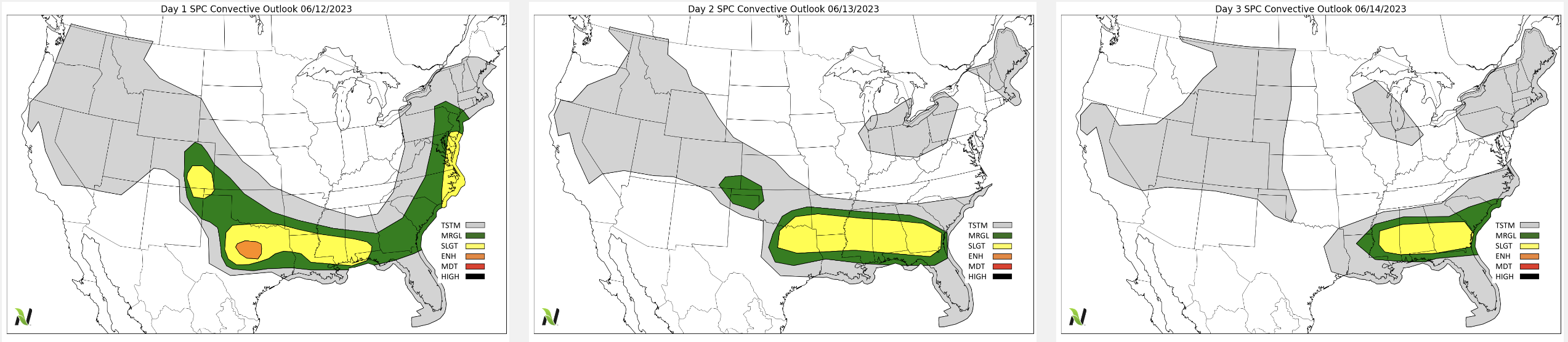
Severe Storms are forecast along the Southern Tier of the US. The first map below shows the next 3 days of convective outlook maps from the SPC.
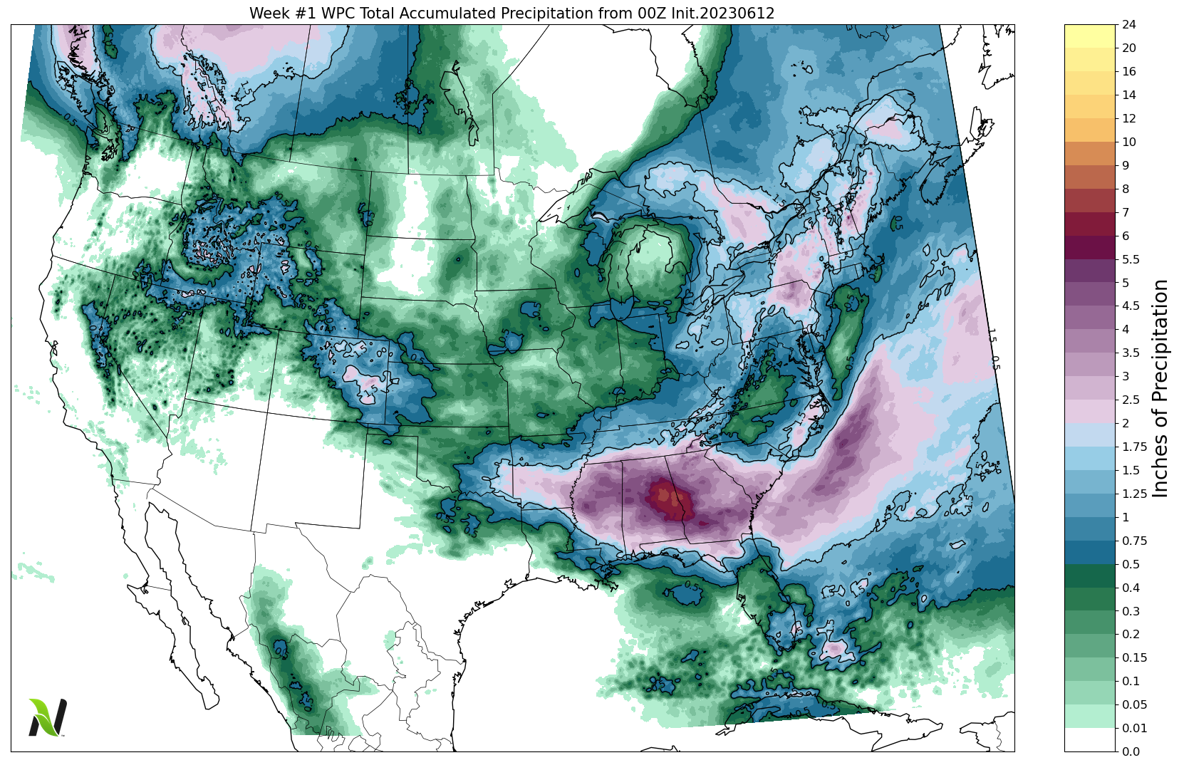
The 2nd map shows the WPC 7-day forecast for total rainfall.
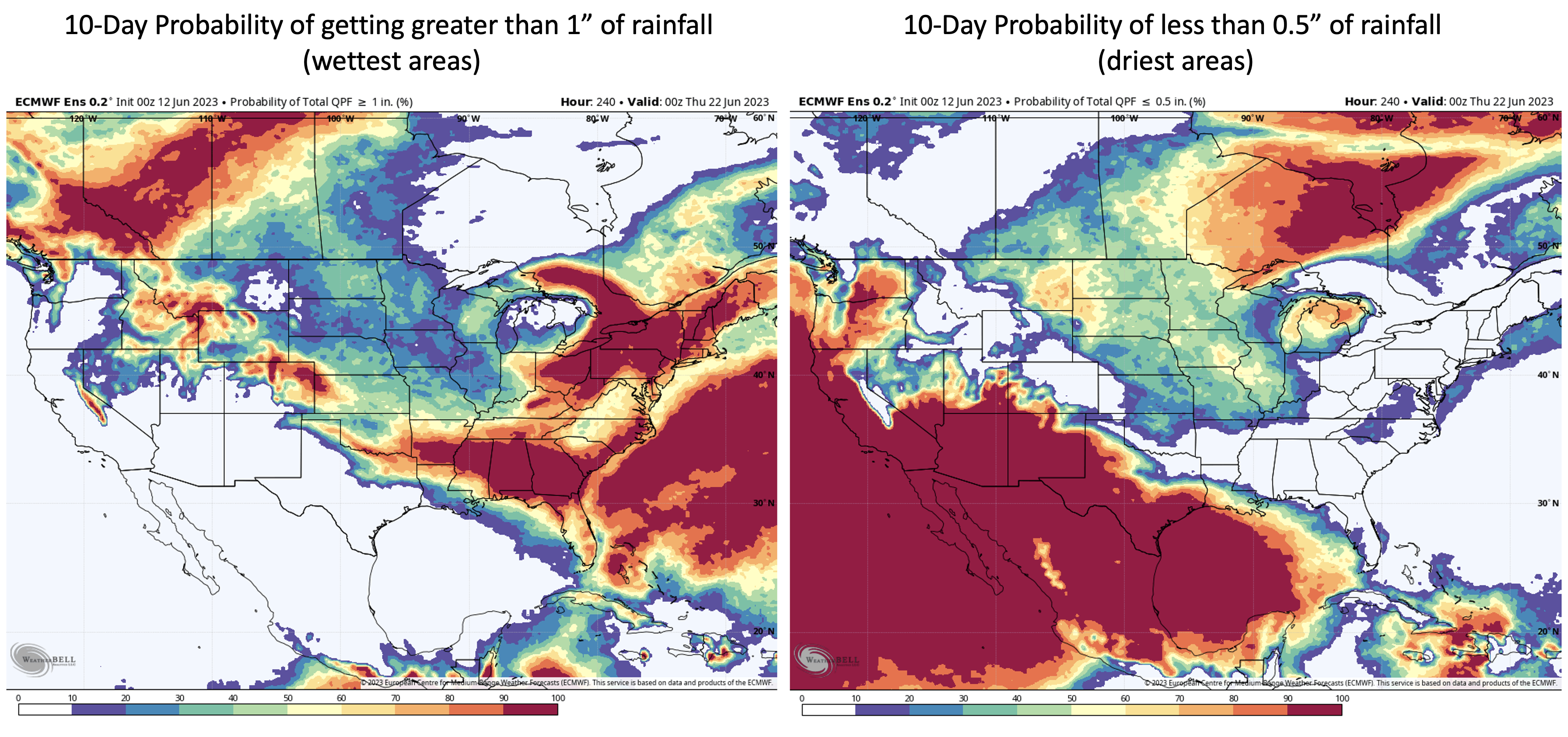
The 3rd panel shows the 10-day probability maps for getting at least 1" of rainfall and less than 0.5" of total rainfall.
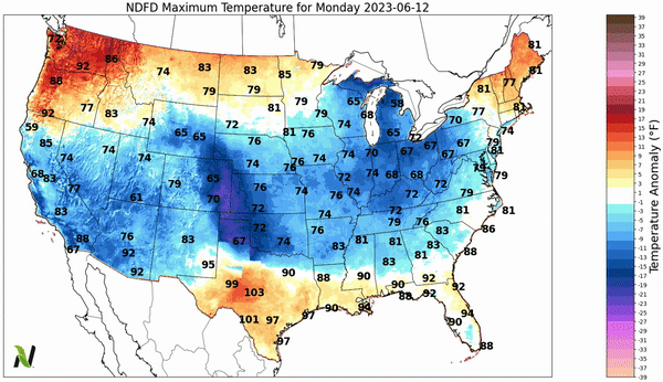
The 4th animation shows the 7-day forecast for high temperatures (anomalies shaded)
SPC Convective Outlook Monday, Tuesday, and Wednesday
WPC 7-Day Forecast for Total Precipitation
10-Day Probabilities of Getting At Least 1" of Total Precipitation and LESS THAN 0.5"
7-Day Forecast of High Temperatures (Anomalies Shaded)
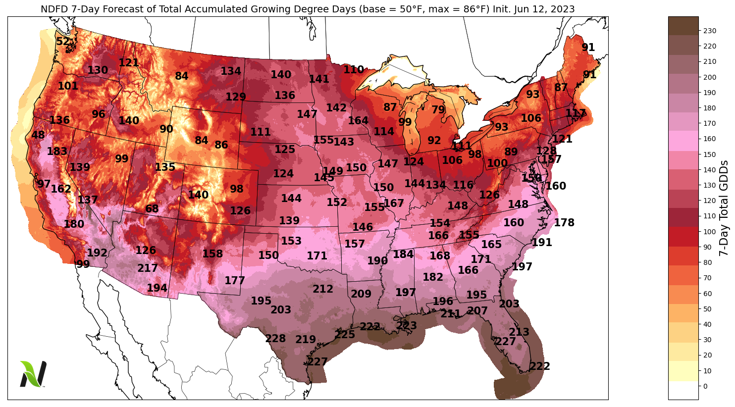
7-Day Forecast of Total Accumulated GDDs
Day 8-14 Forecast
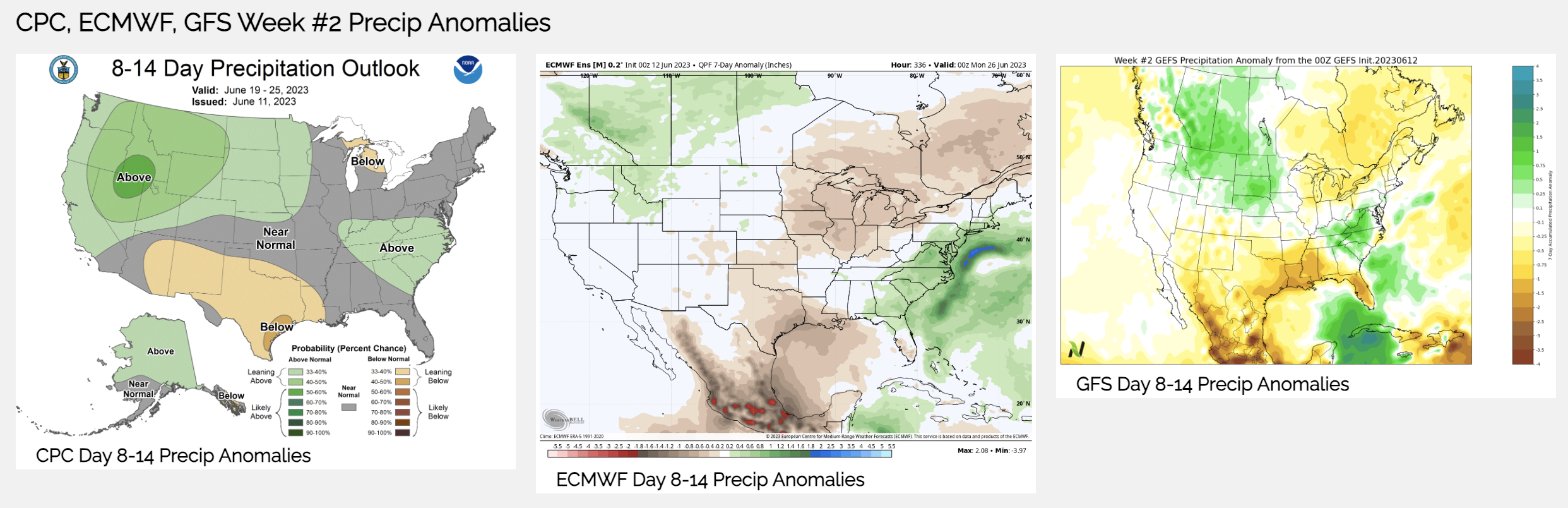
The pattern shift shown in the 2nd section of today's email is playing out in the week #2 outlook shown in the first panel below. The 2nd animation shows the 15-day forecast for average temperature anomalies.
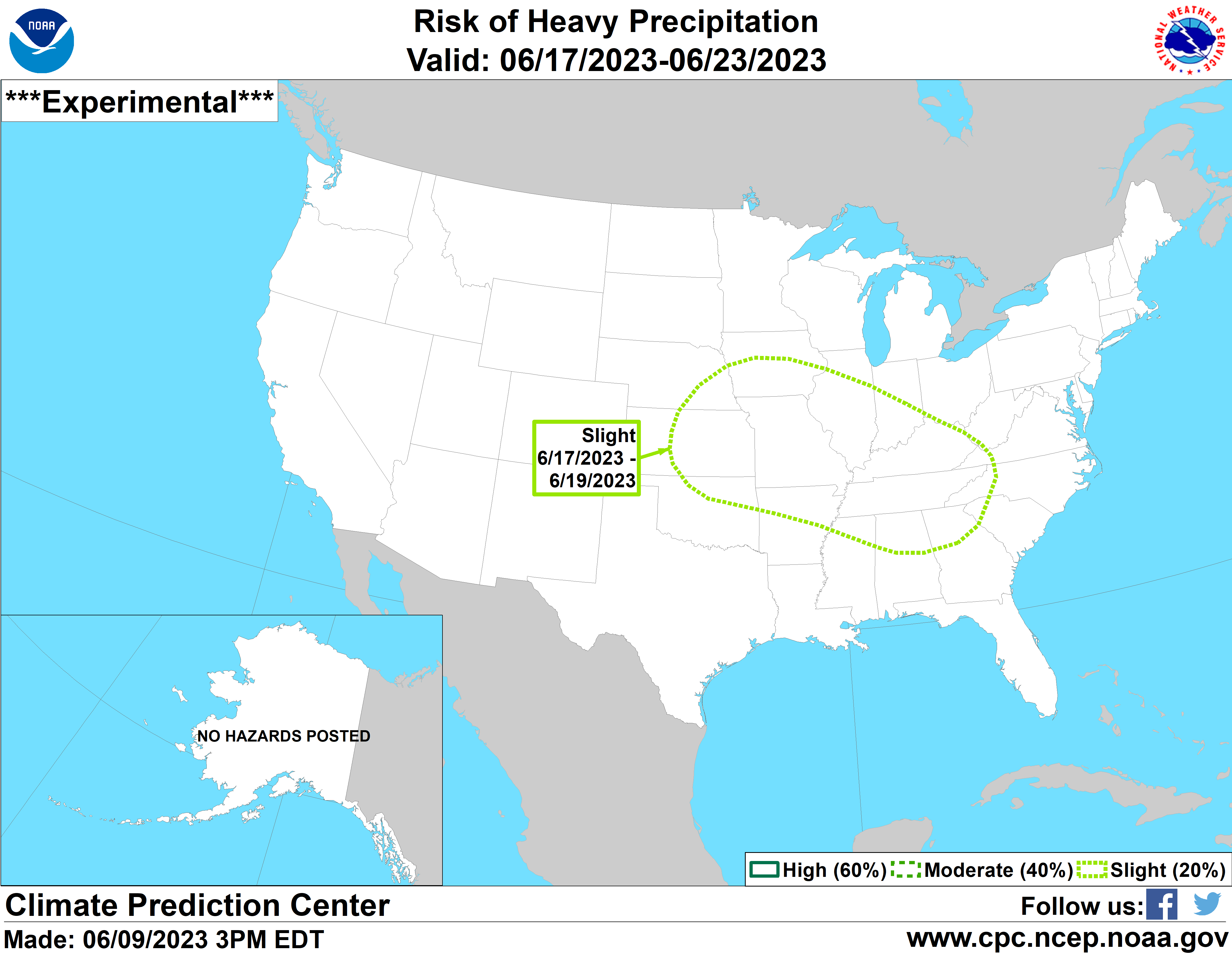
There is a chance that the mid-section of the US sees a lot of severe weather to finish June. The 3rd map below shows the CPC's guidance for heavy rains for the 17th through the 23rd of June.
Week #2 Precipitation Anomalies from the CPC, ECMWF, and GFS
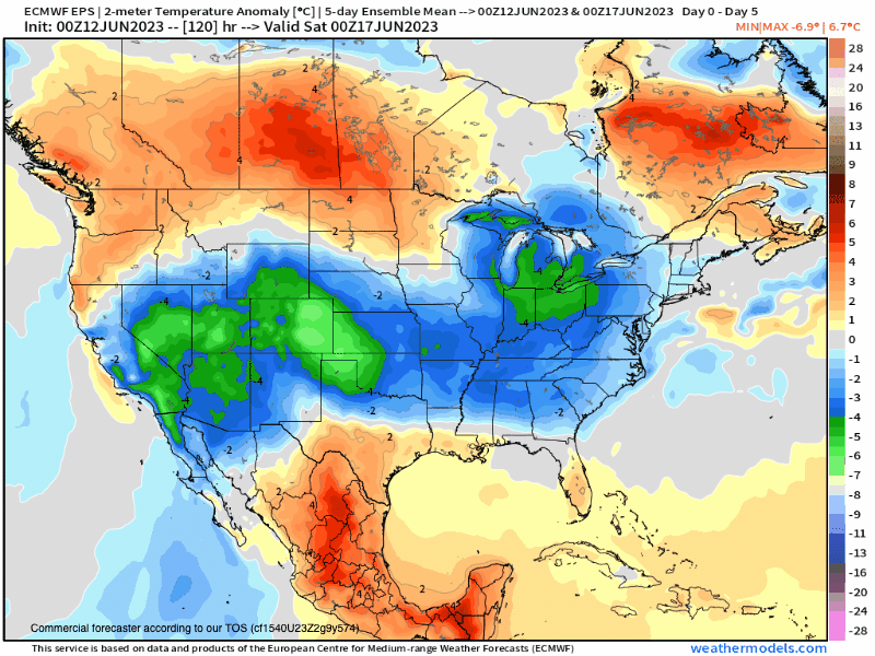
15-Day Forecast of Average Temperature Anomalies (5-day sliding window)
CPC Risk Area for Heavy Rainfall June 17-23, 2023
Day 16-30 Forecast
The CFSv2 and the CPC Outlook for the end of June and start of July are very similar. Lots of storms...
The ECMWF is drier for the Cornbelt and in tonight's in-depth report I will show you the latest ECMWF outlook through mid-July. Remember you can always access these videos on our YouTube Channel.
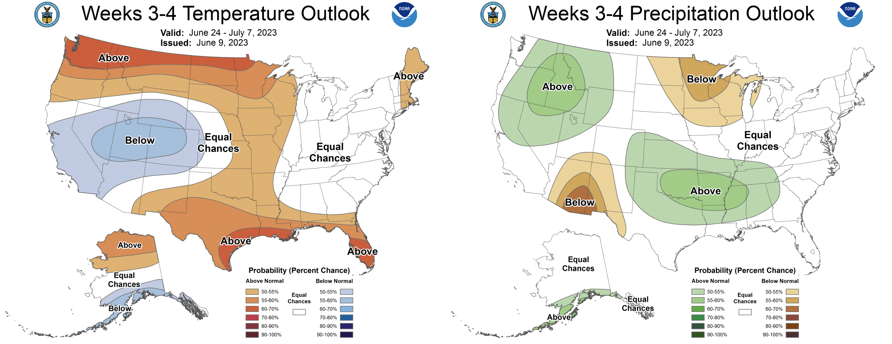
The next map shows the June 24 - July 7 Outlook
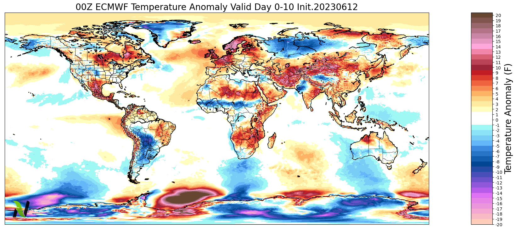
Brief International Update
Colder and much wetter conditions move into Southern Brazil. I did not observe a frost in Southern Brazil this weekend. Heavy rains continue for the Safrinha crop in Southern Brazil. Cold continues for Argentina into Southern and Central Brazil
More storms across Southern Europe from Spain to Turkey
Heavy rains in Southeast Asia, Drier across the Manchurian Plain in China
Drier across Western Russia
Have a good week.
Eric Snodgrass Nutrien Senior Science Fellow Principal Atmospheric Scientist
Nutrien Ag Solutions, 3005 Rocky Mountain Avenue, Loveland, CO 80538, USA